
"Buzzing" BSL in a satellite
Here's the picture that got people buzzing today:
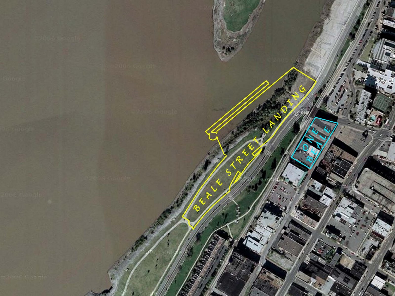
We carefully traced the RDC architect's drawing of the Beale Street Landing complex onto a Google satellite photo of the riverfront. As you can see, BSL (yellow outline) will consume a portion of Tom Lee Park -- an area used to stage concerts during Memphis in May. On the north end, BSL also covers a portion of the lower Cobblestones.
Perhaps, most interesting is the comparison to the size of One Beale when that is built. (On satellite the photo, the One Beale project is outlined in blue.) There are more photos and drawings in our Library. (Also the link at the top of this page.)
By the way, the Memphis Flyer made a small goof when they posted their article: The site actually has nothing to do with the Memphis Public Library. We just call the site "The Library" because it's where we collect external news and commentary articles, official documents, and drawings and photos about our Riverfront. If you look closely at the photo in the upper left corner on the site, you'll see a group of people "gathering at the river" behind the Cossitt Library, which of course sits on the Public Promenade overlooking the Mississisppi.
Important note for "Mac" people: The site may appear to be gibberish when viewed in the Safari browser. That's due to a bug in Safari we haven't been able to discover or correct for. (But it looks fine in Safari 3 Beta on Windows.) If you have a Mac, try to use a different browser, such as Firefox or Mozilla. (Any Mac geeks out there who can solve this bug, we'd love to hear from you!).
Labels: Beale-Street-Landing
posted on 7/25/2007 | Permalink
| Back to Top
![]()
![]()
<< Home